

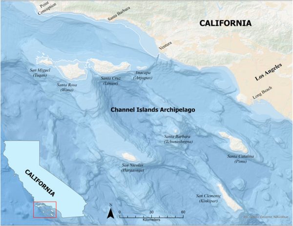
Dr. Jillian Maloney, Luke Johnson (alumni 2020) and collaborators, published a paper in Frontiers this month. Their work adds to our knowledge of the long-term ecology of Santarosae (superisland during lower sea level, composed of todays San Miguel, Santa Rosa, Santa Cruz, and Anacapa Islands) and how the landscape evolved since the late Pleistocence. They also located areas that would have been of interest to hunter-gatherer early maritime peoples.
Abstract: On global, regional, and local scales, sea level histories and paleoshoreline reconstructions are critical to understanding the deep history of human adaptations in island and coastal settings. The distance of any individual site from the coast strongly influences decisions about the transport of coastal resources and has a direct impact on human settlement and resources procurement strategies.
Our ability, then, to identify relic productive habitats, such as wetlands, that were subaerial during time periods relevant to human occupation, is critical to models of human settlement and resource patterning that guide our search to identify cultural resources. Accurate location of productive habitats becomes more critical when searching for terminal Pleistocene sites submerged by postglacial marine transgression. While paleoshoreline reconstructions and sea level histories can provide a baseline for identifying drowned and ancient coastal ecosystems, post-transgressive sediment deposited on the seafloor can skew accurate paleoshoreline location.
To correct for this, we used sub-bottom profiling data from the southern California Coast to determine revised paleoshoreline locations and to identify sonar signatures indicative of paleogeographic contexts that may harbor wetland environments. These data were used to define core sample locations that resulted in the identification of submerged, preserved paleosols. The paleosols data, presented here for the first time, have provided information on ancient landscapes and relic habitats that were subaerial prior to postglacial sea level rise. In our study area on the continental shelf off the California Channel Islands archipelago, the paleosols correspond to a critical period of shifting habitats, evolving landscapes, species extinctions, and the arrival of humans into a rapidly changing ecosystem.
Luke Johnson presented this work to the Department in May of 2020. To read Luke’s abstract and watch his defense click this text.