A Brief Overview of the Geologic History of Western Europe as Illustrated Through Paleogeographic and Paleotectonic Maps

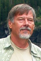
Dr. Ron Blakey
Professor Emeritus, Northern Arizona University
Host: Bonnie Bloeser
Monday, February 20, 2017
CSL 422 – 11 am
Abstract
The amalgamation of Western Europe is an ongoing process that had its beginnings in the Neoproterozoic. Baltica, the nucleus of Europe, went through several episodes of terrane and arc collision during the Paleozoic, culminating in the Caledonian orogen in the Silurian-Early Devonian and the Variscan orogeny in the Late Devonian and Carboniferous. These two events partially determined where subsequent basins and uplifts would occur during the Late Paleozoic, Mesozoic, and Cenozoic. The Variscan massifs and intervening basins are still prominent features across much of Europe. Mesozoic and Cenozoic modification of Variscan elements occurred during the opening of the Alpine Ocean in the Jurassic and its subsequent closing during the various phases of the Alpine orogen. The opening of the Atlantic Ocean and related basins in the North Sea began in the Jurassic and continue today.
These events are clearly illustrated through a series of paleogeographic and paleotectonic maps. These maps allow complicated sedimentary and tectonic events to be clearly illustrated and form the basis for spirited discussion – the events that shaped Europe are anything but with consensus.
Bio
Ron Blakey is Professor Emeritus at Northern Arizona University following 34 years of teaching and research in the Department of Geology. During his tenure at NAU, he studied and published on the stratigraphy and sedimentology of many Late Paleozoic and Mesozoic rock units on the Colorado Plateau. His specific interests are eolian and fluvial depositional systems. This nurtured his interest in paleogeography and for the last 15 years, he has been heavily involved in producing paleogeographic maps that range from regional to global in scope. Many of these maps appear on his web site, deeptimemaps.com. His latest endeavors have merged these two disciplines into books published by the Grand Canyon Association, “Ancient Landscapes of the Colorado Plateau” and Springer, “Plate Tectonics, Continental Drift, and Mountain Building”. He is currently preparing a new book on the ancient landscapes of Western North America. His degrees are from Wisconsin (BS), Utah (MS), and Iowa (PhD).

