|
|
Earthquake-Induced Liquefaction Mapping for Rapid Response and Loss EstimationEric Thompson Wednesday, October 16th, 2013 |
||
|
|||
| ABSTRACT
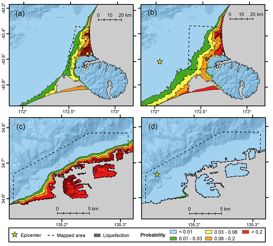
Earthquake-induced liquefaction is the loss of shear strength in soil due to increased pore pressure, and is a major factor contributing to infrastructure and lifeline damage during earthquakes. Existing regional liquefaction hazard maps are valuable earthquake hazard products, yet they remain difficult to incorporate into rapid response, loss estimation, and emergency planning efforts. We describe an approach to model liquefaction extent that focuses on identifying broadly available geospatial variables (e.g., derived from digital elevation models) and earthquake-specific parameters (e.g., peak ground acceleration, PGA). A key step is database development: we focus on the 1995 Kobe and 2010/2011 Christchurch earthquakes because the presence/absence of liquefaction has been mapped so that the database is unbiased with respect to the areal extent of liquefaction. We derive two different liquefaction models with explanatory variables that include PGA, shear-wave velocity, compound topographic index, and a newly defined normalized distance parameter (distance to coast divided by the sum of distance to coast and distance to the basin inland edge). To check the portability/reliability of these models, we apply them to the 2010 Haiti earthquake. We conclude that these models provide first-order approximations of the extent of liquefaction, appropriate for use with ground motion simulations, rapid response assessment, and loss estimation.
|
|||